- Buraneta
- Sightseeing
- View-spot
- Ehime
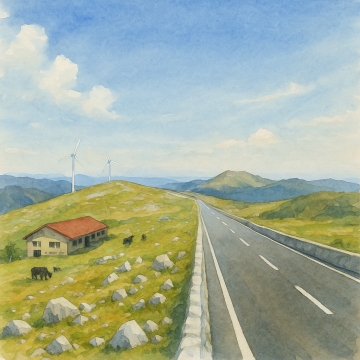
- Nametoko Canyon
Nametoko Canyon
- ID:844
 (30)
(30) (30)
(30)
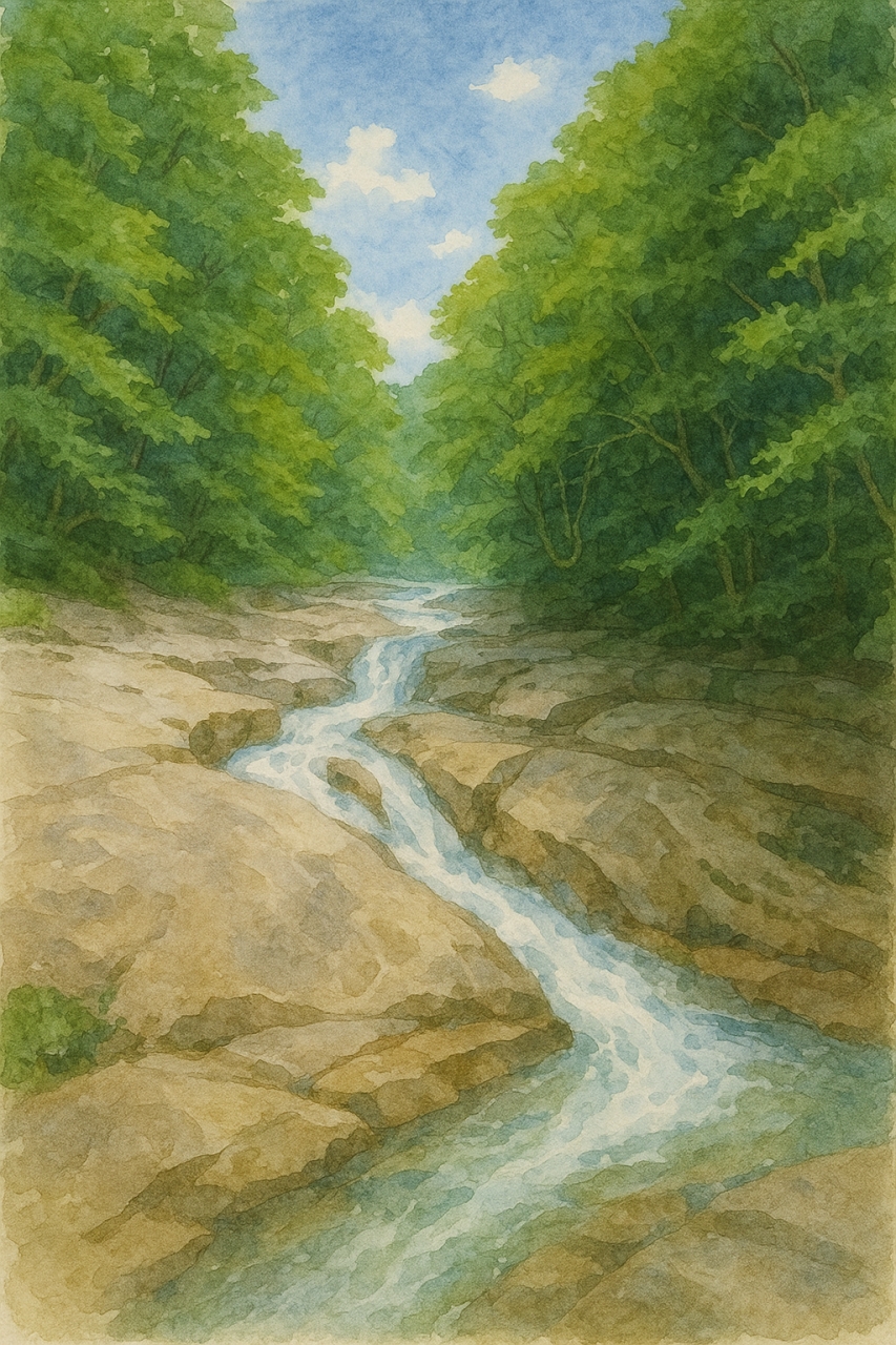
There is a walking trail along the valley, where you can enjoy forest bathing and visit various waterfalls and pools of various sizes. The clear water flow and the space surrounded by lush greenery provide healing and peace to visitors. In particular, in the summer, you can touch the cool water of the valley, making it a popular summer resort. In recent years, activities such as canyoning have also become popular, allowing you to experience nature in a more dynamic way.
It's deep in the mountains and takes about a two and a half hour drive from Matsuyama city, or about an hour and a half from Uwajima city.
Prefectural Route 317 is narrow and dangerous in places, so if you're not confident in your driving, it's probably better to take a slight detour and take Prefectural Route 8 then Prefectural Route 270.
Free (additional fees apply for activities such as canyoning)
[Opening hours]
Free to explore
(However, Nametoko Visitor Center Mannenso is open from 9:00 to 17:00, closed on Mondays)
[Parking]
Free (approximately 150 cars in total at multiple locations)
- Category
- 愛媛南|View-spot|渓谷
- Adress
- ⧉ 愛媛県宇和島市野川滑床 [View Map]
- Official Website
- ⧉ https://www.uwajima.org/spot/index11.html
- TEL
- ⧉ 0895-42-2004 (from overseas: +81-895-42-2004)
(Info may be outdated. Check official site or call for updates.)
Popular Nearby Attractions & Food Spots

Japanese Garden: Tenshakuen Garden
- 20
 10
10- ⧉ View Map

Uwajima Castle
 64
64- 10
- ⧉ View Map

Michi-no-eki Minato Oasis Uwajima Kisaiya Hiroba
- 38
- 11
- ⧉ View Map

Roadside station hence Nishitosa
 40
40 16
16- ⧉ View Map

Roadside Station Shimanto Towa
- 38
- 20
- ⧉ View Map

Largest Japanese garden
- 40
- 21
- ⧉ View Map

Iwama sinking bridge
- 35
- 23
- ⧉ View Map

Uwa Cultural Village
 17
17 30
30- ⧉ View Map

Uchiko Townscape Preservation District
- 54
- 35
- ⧉ View Map

Sukiya-style building and borrowed landscape garden - Garyu Sanso
- 46
- 40
- ⧉ View Map

Reconstructed wooden castle tower - Ozu Castle
- 62
- 41
- ⧉ View Map

Sata no Chinkabashi Bridge
- 50
- 41
- ⧉ View Map

Daido Coast
- 38
- 44
- ⧉ View Map

Ishigaki no Sato
- 25
- 44
- ⧉ View Map

Movie location! JR Shimonada Station
- 46
 51
51- ⧉ View Map

Michi-no-eki Aguri Kubokawa
- 28
- 52
- ⧉ View Map

Road Station Bios Ogata
- 31
- 54
- ⧉ View Map

Michi-no-eki Nabura Tosa Saga
- 37
- 56
- ⧉ View Map

Great view! Shikoku Karst
- 64
- 57
- ⧉ View Map

Nagahama Bridge (Red Bridge)
- 22
- 58
- ⧉ View Map

Okitsu Beach (Kochi Prefecture)
- 60
- 59
- ⧉ View Map

Ashizuri Underwater Observation Tower
- 30
- 62
- ⧉ View Map

Tatsukushi in Senjojiki
- 38
- 62
- ⧉ View Map

Oki Coast
- 50
- 67
- ⧉ View Map

Ehime Prefectural Tobe Zoo
- 55
- 69
- ⧉ View Map

Straw-grilled bonito! Kuroshio Kobo
- 47
- 70
- ⧉ View Map

Futana Island
- 20
- 72
- ⧉ View Map

Matsuyama Comprehensive Park
- 32
- 72
- ⧉ View Map

Experience Resort of Farming and Mountain Village Life
- 27
- 75
- ⧉ View Map
[Selections]Popular sightseeing spots around Ehime Prefecture
「view-spot」Sightseeing spots around Ehime Prefecture
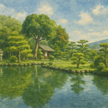
Japanese Garden: Tenshakuen Garden
Tenshō-en is a garden built by Munenori Date, the 7th lord of the Uwajima clan, as a place of retire...
- 10
- [+]愛媛県宇和島
- 20

Largest Japanese garden
Minami Rakuen, located in Uwajima City, Ehime Prefecture, is a Japanese garden with a pond that open...
- 21
- [+]愛媛県宇和島
- 40

Iwama sinking bridge
The Shimanto River, known as "Japan's last clear river" and flowing through Shimanto City, Kochi Pre...
- 23
- [+]高知県四万十
- 35
Sukiya-style building and borrowed landscape garden - Garyu Sanso
Garyu Sanso is a famous piece of architecture built in a scenic spot overlooking the clear waters of...
- 40
- [+]愛媛県大洲市
- 46

Sata no Chinkabashi Bridge
高知県四万十市に位置する今成橋は、地元では「佐田沈下橋」の名で親しまれ、四万十川に架かる沈下橋の中でも最も長く、最も下流にあることで知られています。欄干がないシンプルな構造は、増水時に橋が水中に沈むこ...
- 41
- [+]高知県中村市
- 50

Daido Coast
Odoyama Observatory is a symbol of Odo Coast, which spreads along the coastline of Otsuki Town, Hata...
- 44
- [+]高知県高知県
- 38
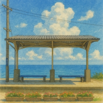
Movie location! JR Shimonada Station
JR Shimonada Station is an unmanned station located in Iyo City, Ehime Prefecture, famous nationwide...
- 51
- [+]愛媛県伊予市
- 46
Great view! Shikoku Karst
Shikoku Karst is a magnificent karst plateau that stretches for about 25 km from east to west, with ...
- 57
- [+]愛媛県上浮穴
- 64

Nagahama Bridge (Red Bridge)
Nagahama Ohashi Bridge is a beautiful red bridge located in Nagahama-cho, Ozu City, Ehime Prefecture...
- 58
- [+]愛媛県大洲市
- 22

Tatsukushi in Senjojiki
Tatsukushi, located in Tosashimizu City, Kochi Prefecture, is a group of strange rocks that look lik...
- 62
- [+]高知県土佐清
- 38

Futana Island
Legend has it that long ago, demons from Onigashima brought two large rocks to help the people of Ku...
- 72
- [+]高知県高岡郡
- 20
The westernmost point of Shikoku! Sadamisaki
From the Tsubakiyama Observatory, you can see the lighthouse, the Hoyo Strait, and the Saganoseki Pe...
- 77
- [+]愛媛県西宇和
- 50
close